
Georgetown ZIP Directory Coverage
The verified city code is 40324. The Kentucky Department for Local Government city record pairs it with incorporated Georgetown, while the state ZIP list identifies Sadieville and Stamping Ground as separate Scott County postal communities. Midway is useful only as nearby context. It is primarily a Woodford County postal city and has not been verified as serving Georgetown parcels.
| ZIP | Documented area | Postal point | Geography note |
|---|---|---|---|
| 40324 | Georgetown | Georgetown Post Office | Verified on the city record; check edge addresses with USPS |
| 40370 | Sadieville, Scott County | Separate postal community | Not a Georgetown city ZIP |
| 40379 | Stamping Ground, Scott County | Separate postal community | Municipal limits use a separate map layer |
| 40347 | Midway, mainly Woodford County | Adjacent postal city | Not verified for Georgetown or Scott County parcels |
No official source reviewed identified a second code for an incorporated Georgetown neighborhood, a local PO-box-only code, a unique-use code, or a dated split. That gap matters. A careful ZIP code directory should not manufacture extra coverage to make a longer list.
The state ZIP list serves a different purpose from USPS address verification. It is useful for seeing that 40370 and 40379 belong to named Scott County communities, while the live postal tool answers the narrower delivery question. Keep the source beside the result so a Georgetown directory search does not quietly turn county context into a city claim.
Verify a Georgetown Postal Address
The USPS ZIP Code Lookup is the controlling address-level check in the researched source set. Use the full mailing address for an edge property instead of relying on a citywide list. The Georgetown Post Office listing identifies the local postal facility at 101 N Bradford Lane and supplies the 40324-9998 facility code.
The image below shows the official USPS city-and-state lookup route. It confirms where to test a mailing line, not who occupies an address.
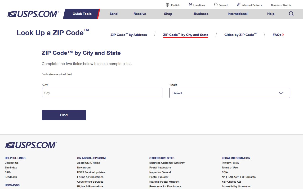
Once USPS returns the delivery code, keep that result beside the source date. Postal assignments can differ from the city layer used for permits, taxes, and council records.
Find Georgetown Residents by ZIP
Finding a person within one code takes several steps because no general official ZIP-wide resident roster was located. The PVA advertises property search, but its verified tutorial documents address, owner name, and GIS Map ID rather than a ZIP filter. Parcel Finder supports address autocomplete and map browsing. Kentucky VIC asks for a legal name and birth date, not a ZIP.
- Confirm the exact delivery code with USPS. Save the complete mailing line rather than the code alone.
- Enter the address in the Scott PVA or GSCPC Parcel Finder. Record the map ID, situs address, and legal description that the live result actually displays.
- Use the name tied to the parcel in the Scott County Clerk party index. A deed record follows names and document types, not the postal code.
- If a voter record is relevant and access is lawful, use VIC for one known person or the regulated SBE-84 route for an eligible official extract.
Once the search narrows to a road, the Georgetown directory by street explains the address-to-parcel chain in full. The ZIP code directory stays at postal scale.
Georgetown ZIP Search Modes
Each public tool uses its own key. A ZIP field on one system does not mean another system can produce the same list. These observed modes set realistic limits before a search begins.
| Official tool | Observed input | Useful result | Limit |
|---|---|---|---|
| USPS lookup | City/state or exact address | Delivery ZIP verification | Not a resident roll |
| Scott PVA | Address, owner, map search advertised | Parcel starting point | No verified ZIP filter |
| GSCPC Parcel Finder | Address autocomplete and map | Parcel and adjacent context | No ZIP layer verified |
| Kentucky VIC | Legal first name, last name, birth date | Registration and polling purpose | No ZIP-wide browse |
| SBE-84 | Qualified requester and geographic scope | Regulated voter extract | Eligibility, oath, and use limits |
When the PVA page cannot be reached, call or visit the office at 101 E Main Street, Suites 203–206. The researched hours are weekdays from 8:30 a.m. to 4:30 p.m., and the phone is 502-863-7885.
The clerk and Planning Commission provide further fallbacks. The clerk is at 101 E Main Street and can retrieve a known land document or plat through the deed room and request form. GSCPC supplies the parcel and city-limit layers. Neither office should be asked to produce an undefined list of everyone within a postal code.
Georgetown ZIP and City Limits
A Georgetown mailing line, a parcel situs, the owner mailing address, and the incorporated city boundary are four separate record keys. The GSCPC CityLimits service maps Georgetown, Sadieville, and Stamping Ground as municipal areas. It does not draw the USPS delivery boundary or settle a legal parcel line.
The official city-boundary service is visible in the image below. Compare this layer with the USPS answer whenever a record depends on city jurisdiction.
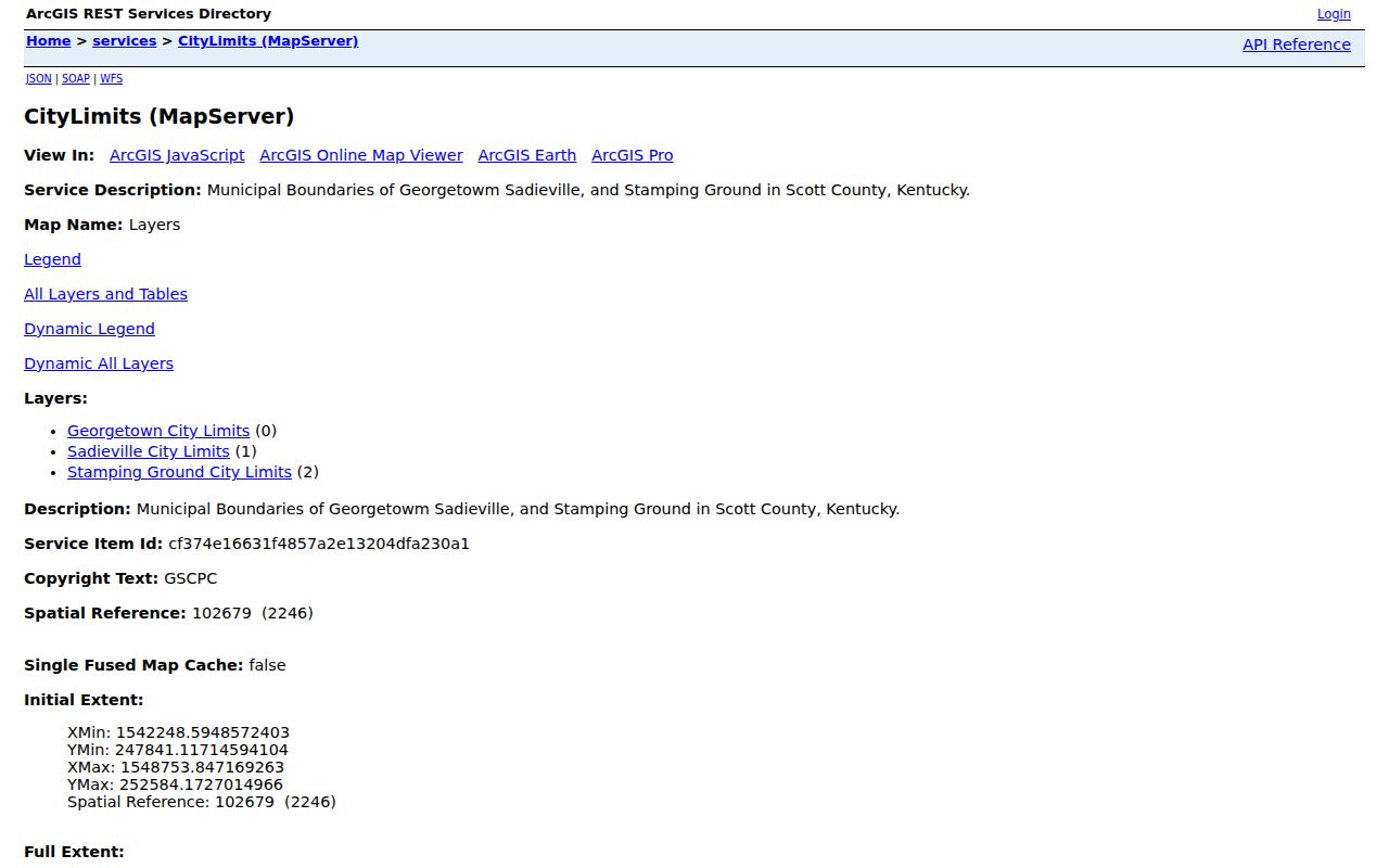
The separation prevents a common mistake: treating every address printed with Georgetown as incorporated territory. A permit or code request may belong to a different custodian even when the mail arrives under the Georgetown name.
- ZIP
- A five-digit USPS delivery code. It does not define city limits.
- ZIP+4
- A delivery refinement for a smaller group of addresses, boxes, or a high-volume receiver.
- PO-box ZIP
- A code reserved chiefly for post-office boxes. None was verified for Georgetown.
- Unique ZIP
- A code assigned to one large receiver. None was found in the local research.
- Carrier route
- A postal delivery path within a ZIP, not a parcel, precinct, or neighborhood boundary.
The Georgetown City Record
State and local government records give scale and jurisdiction, but they do not create a ZIP population roster. The DLG entry identifies Georgetown as a Scott County city and ties it to 40324. Census QuickFacts reports city and county totals on municipal and county geographies. Neither source publishes the number of residents inside the USPS delivery area.
The DLG screen assigned to this ZIP code directory is shown below. It is a reliable city identity check and should be read alongside USPS for mailing geography.
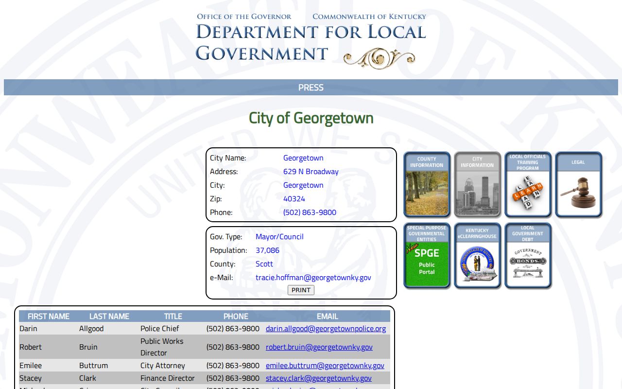
Use those totals only as context. The 2020 city count was 37,086, while Scott County counted 57,155. Those figures cannot be divided among ZIPs without a source that actually uses ZIP geography.
QuickFacts also reports the city and county land areas, but those areas follow census boundaries. They cannot show which carrier route serves a subdivision or whether a particular delivery point crosses the incorporated line. Use census data to understand Georgetown’s scale, then return to the address-level postal and parcel sources.
Georgetown Post Office Context
The Georgetown USPS location page supplies a concrete postal anchor. It identifies the office but does not claim that all 40324 delivery points fall within the incorporated boundary. A post-office listing also does not distinguish owners, renters, household members, or businesses at each stop.
The official location result appears in the following capture. Check its live page before relying on service details that can change.
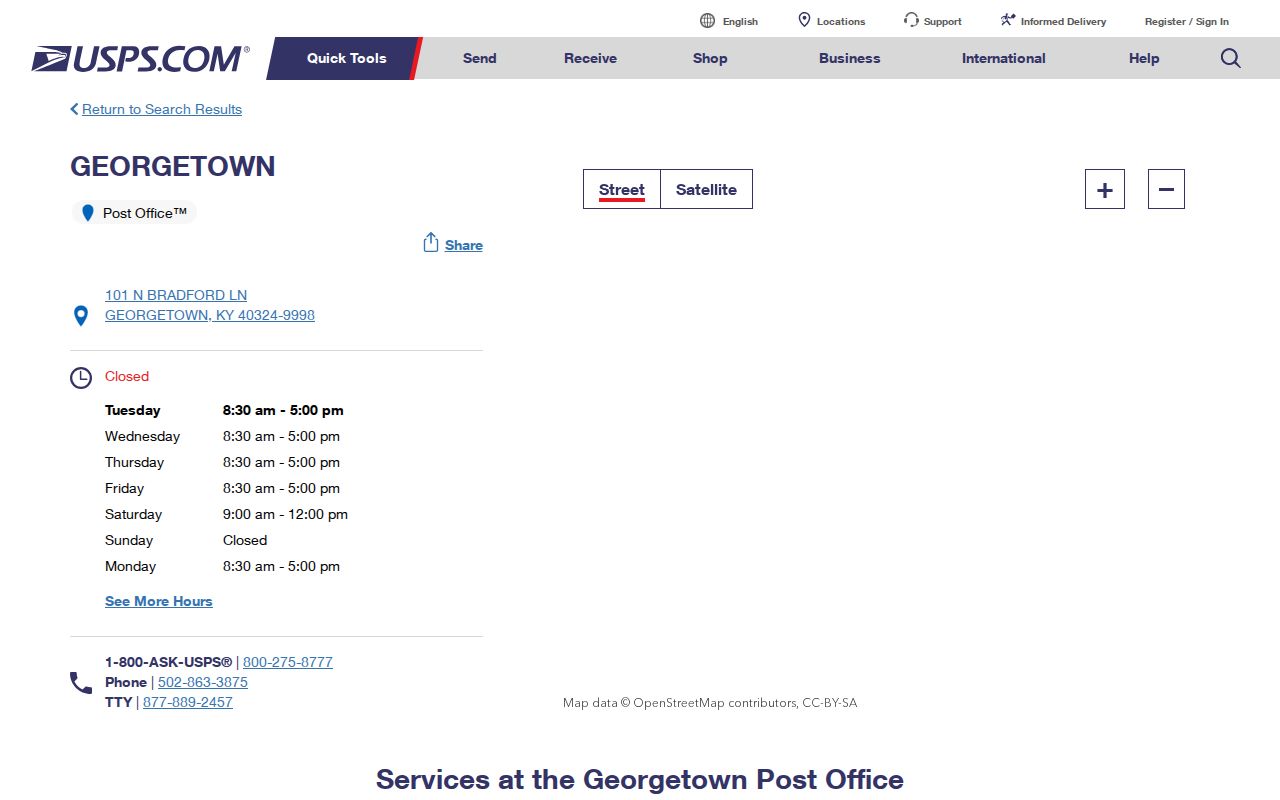
For an individual address, the city/state form and address lookup remain more precise than the office page. For a parcel question, switch from USPS to GSCPC or the PVA.
Key point: 40324 is verified for Georgetown, but no official parcel-level ZIP boundary file was found.
Georgetown Records Beyond ZIP
Parcel, election, and deed systems do not share one geography. The PVA follows a property situs and tax mailing address. GSCPC follows map geometry. The clerk follows party names, legal descriptions, and recorded instruments. Election files follow precinct and statutory list fields. A person can appear under related but nonmatching keys without any record being wrong.
If an online portal fails, use the documented channels. Contact the PVA or Planning Commission for parcel and map questions. Ask the Scott County Clerk for a known deed or plat by form, mail, email, or at the deed room. A city permit or code file can be requested through Georgetown open records with an exact address and date range. Historical questions can move to Kentucky Room microfilm, digitized deeds, plats, or the 1912 Sanborn map.
Broad requests should be narrowed. Name the custodian, address set, record type, and dates. That gives the office a real search target and avoids implying that it keeps a ZIP-wide household list.
Historical sources can resolve a place when a current mailing label is too new. Recorded plats and deeds preserve legal descriptions, the Kentucky Room preserves local microfilm, and the 1912 Sanborn map preserves an older built environment. None supplies a modern ZIP directory by itself, but together they can identify the same site across changing systems.
One Georgetown Address, Four Keys
The strongest local misconception is that all address fields are interchangeable. They are not. A situs address locates the physical parcel. A tax mailing address tells the PVA where to send correspondence when that field is shown. A legal description preserves lot, block, subdivision, or metes-and-bounds identity. USPS supplies delivery geography.
This distinction is especially important near city edges. Keep the full address, parcel map ID, legal description, postal result, and map date together. If an older record uses a different street form, bridge it with lot and subdivision data rather than guessing that Georgetown had a citywide renumbering. No official renumbering year or crosswalk was located.
Note: A current ZIP result is a postal fact, not proof of municipal jurisdiction, parcel ownership, or residence.